
On Sunday, June 18, my ecology class visited three sites in the Inner Coastal Plain: Mount Holly, a forested cuesta; Timbuctoo, a historic settlement founded by free Blacks in 1826; and Rancocas State Park, a protected area along the North Branch of Rancocas Creek. The day was sunny and warm, although comfortably cool in the shade.
Since we began our exploration at the summit of Mount Holly–an unusually high point of elevation in the Inner Coastal Plain–and ended near the tidal freshwater marsh along the North Branch of Rancocas Creek, we had excellent vantage points to consider how elevation impacts the kind of soil we found and the kinds of plant communities that grew there. We also had the opportunity to contrast soils from two different geological formations: specifically, the Tertiary Kirkwood formation and the Cretaceous Marshalltown formation.
Mount Holly
Mount Holly rises like an island from the suburban sea of a town also called Mount Holly. Unsurprisingly, given this proximity, there were a number of introduced species (including Norway maple, Acer platanoides) in the forested cuesta–especially at the foot of the trail, just across the street from nearby residences. Further up, the forest on Mount Holly is stewarded by the Mount Holly Environmental Committee, who borrow goats to help limit the growth of the opportunistic introduced vine English ivy (Hedera helix).
We walked to the summit, approximately 160 feet in elevation. The tallest trees (estimated 80-100′ tall) included white oak (Quercus alba), American beech (Fagus grandifolia), mockernut hickory (Carya tomentosa), and scarlet oak (Quercus coccinea). In the subcanopy, there were sapling tulip trees (Liriodendron tulipifera), sassafras (Sassafras albidum), red maple (Acer rubrum), and flowering dogwood (Cornus florida) which I recognized from its paired leaves. In Tree Tenders, we were taught MAD HORSE to recognize species with opposite rather than alternating leaf formation, although I learned on this trip that there are several other species (such as viburnums) with this formation.
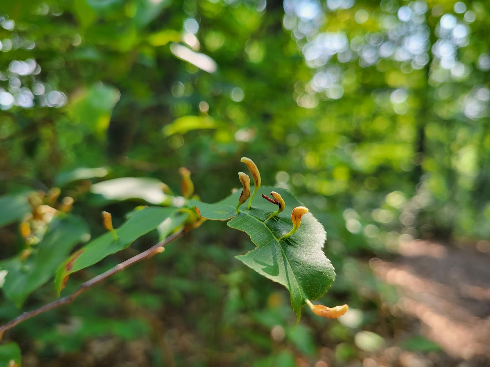
In the shrub layer, we saw many of the mature tree species in sapling form, including many white oaks–evidently the result of a mast year for acorns, and able to grow due to the absence of deer (which cannot easily reach the isolated cuesta forest). Some of the shrub-like black cherry trees (Prunus serotina) were covered in brightly colored growths: black cherry finger gall mite (Eriophyes cerasicrumena). Copious brambles, notably common greenbrier (Smilax rotundifolia) and raspberry/blackberry species (Rubus spp.), and poison ivy (Toxicodendron radicans) spread throughout. On the forest floor, we identified the white buds of spotted wintergreen (Chimaphila maculata) and the unusually named hairy forked nailwort (Paronychia canadensis), the latter of which is endangered in some states. There were a number of fallen trees, possibly due to wind and storm damage, as the high elevation cuesta is vulnerable to wind. As the trees decayed, they provided habitat and food to ants (Formicidae sp.) and fungi, including mossy maze polyphore (Cerrena unicolor).
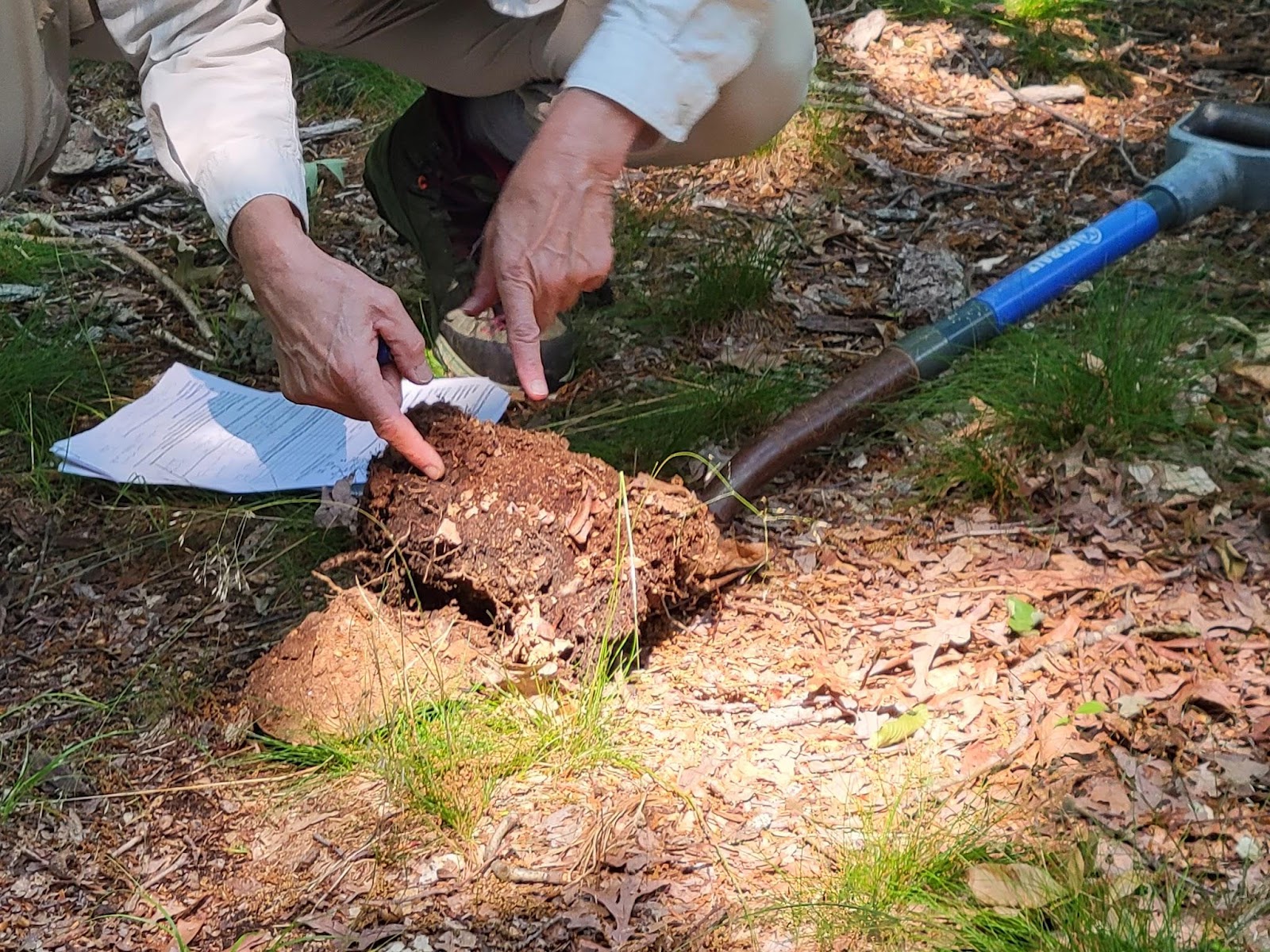
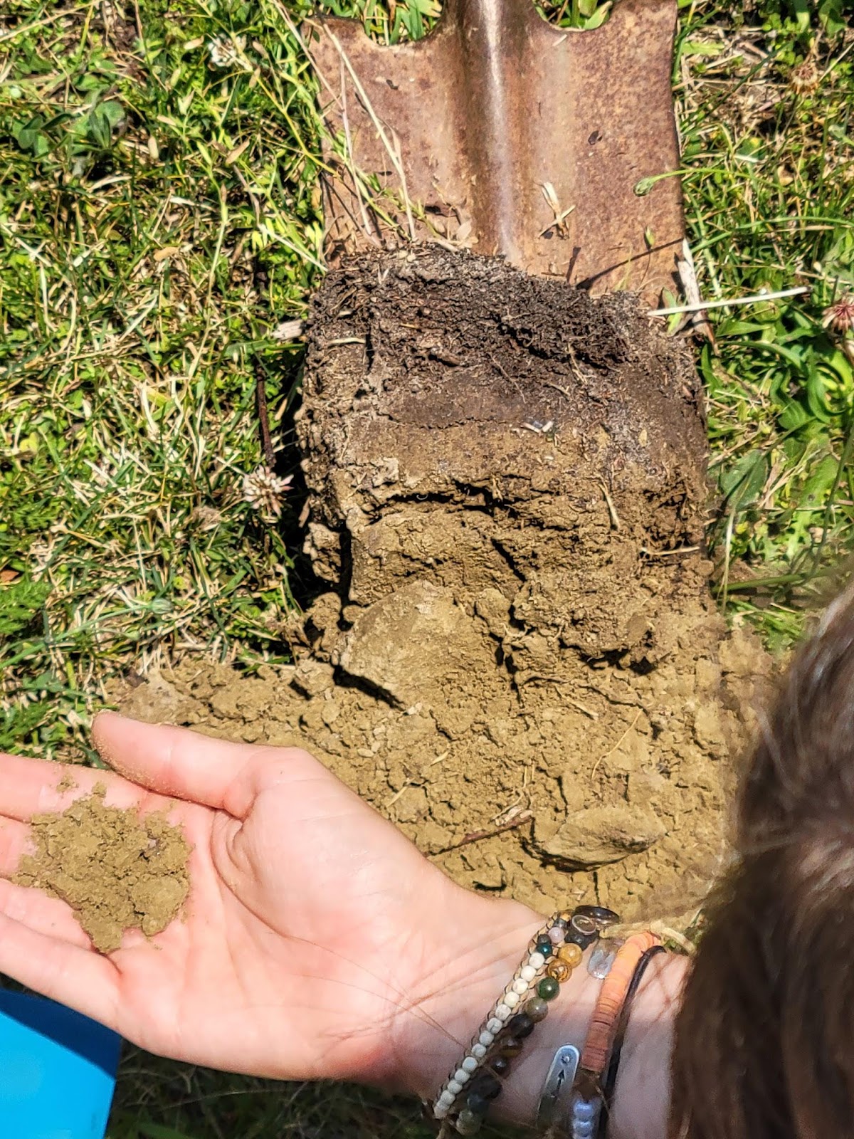
On the trail, we could see fragments of reddish-brown stone, remnants of the ironstone-rich slabs that made this cuesta resistant to erosion compared to the rest of the Inner Coastal Plain. A soil sample showed well-defined horizons:
- Oi: 0-1″ composed primarily of oak leaves
- Oe: 1-3″ of partially decomposed material
- A: 3-5″ of sandy loam, dark brown in color
- B: below 5″, sandy loam with a dusky red color from the ironstone fragments

As we examined the soil, we heard the sound of something crashing through the branches of the tall summit trees: two or three turkey vultures (Cathartes aura) (Photo 4), which seemed to be interacting with each other (playing? courting?) rather than pursuing carrion on the ground. The Merlin app also picked up tufted titmouse (Baeolophus bicolor), cedar waxwing (Bombycilla cedrorum), common grackle (Quiscalus quiscula), downy woodpecker (Dryobates pubescens), American robin (Turdus migratorius), and red-eyed vireo (Vireo olivaceus).

Timbuctoo
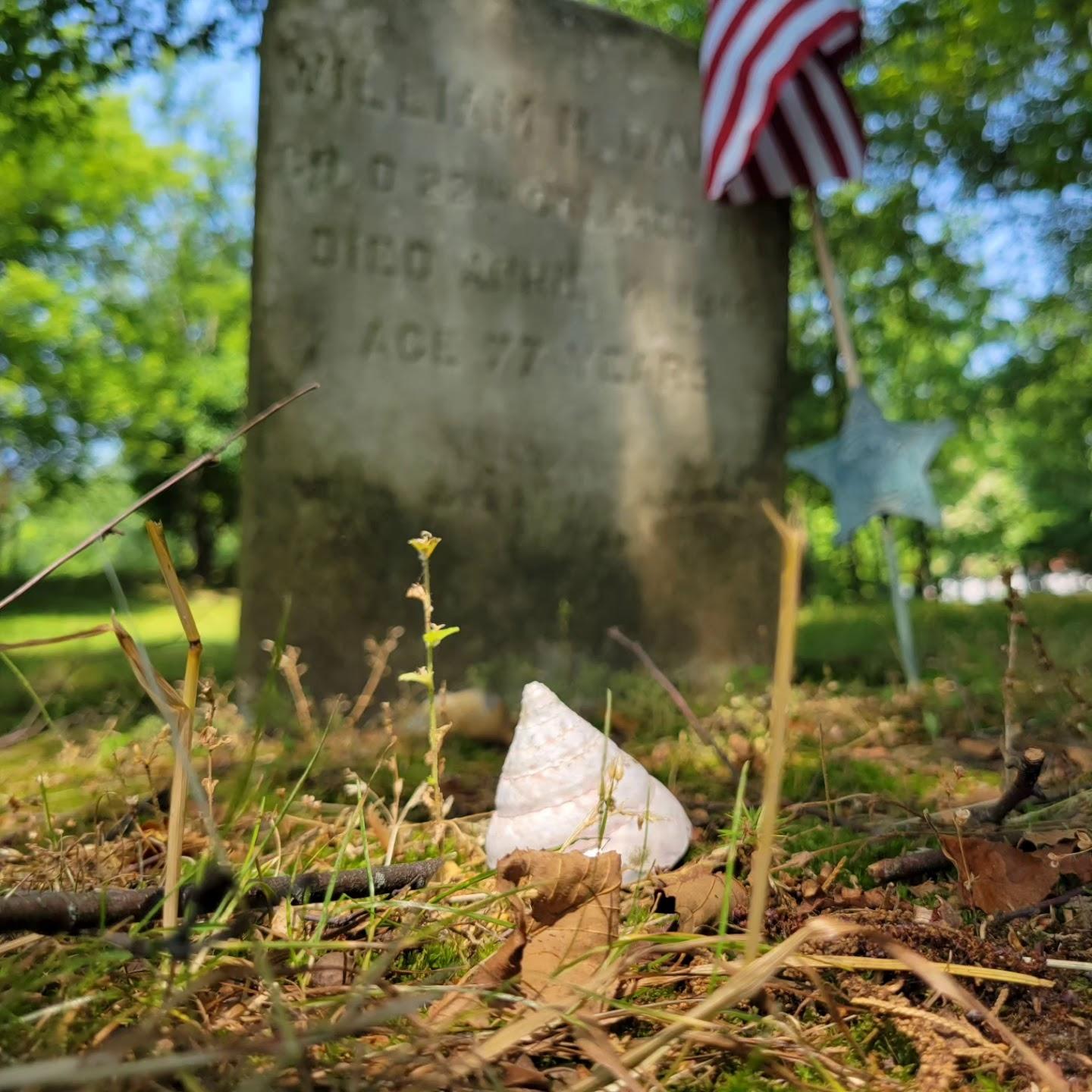
We stopped at the cemetery at Timbuctoo, a community founded by free Blacks in New Jersey two hundred years ago. It is not incorporated as a town, but some of the descendants of the original residents still live there, and there is a historical society dedicated to preserving their heritage. Flags adorned many of the graves belonging to veterans of the Civil War, and visitors had left coins (signifying that someone visited this grave) and seashells (possibly signifying a long journey) on the gravestones.
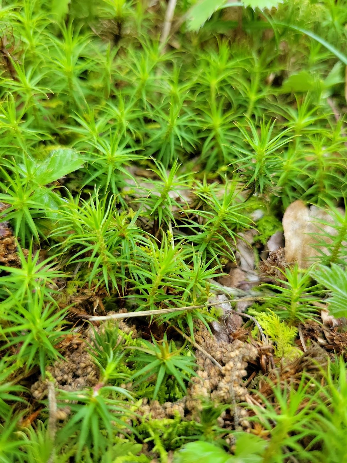
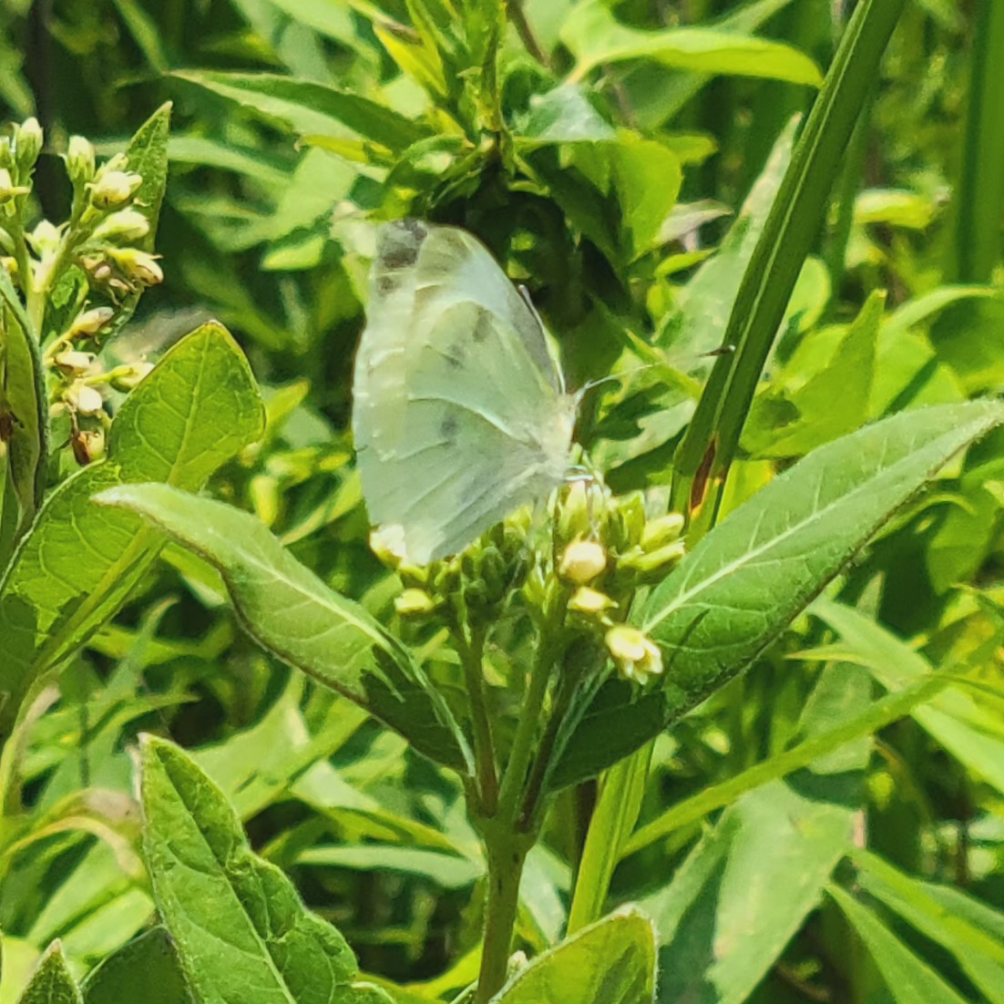
There were attractive plantings at the cemetery entrance, inviting several butterflies including the cabbage white (Pieris rapae). In this somewhat moist, low-elevation environment, we walked beneath mature hickory species–possibly bitternut (Carya cordiformis), according to my app. I also noticed a wide, spongy patch of common haircap moss (Polytrichum commune).

Rancocas State Park
Located along the North Branch of the Rancocas Creek, Rancocas State Park is a protected area that encompasses land that was once used for crops and pastures. The area varies in elevation, about 40 feet at the Nature Center to the low-lying tidal freshwater marsh along the creek, and the trails wind through several distinct plant communities.
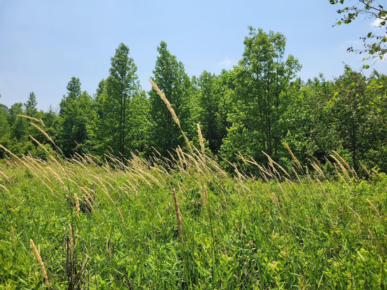
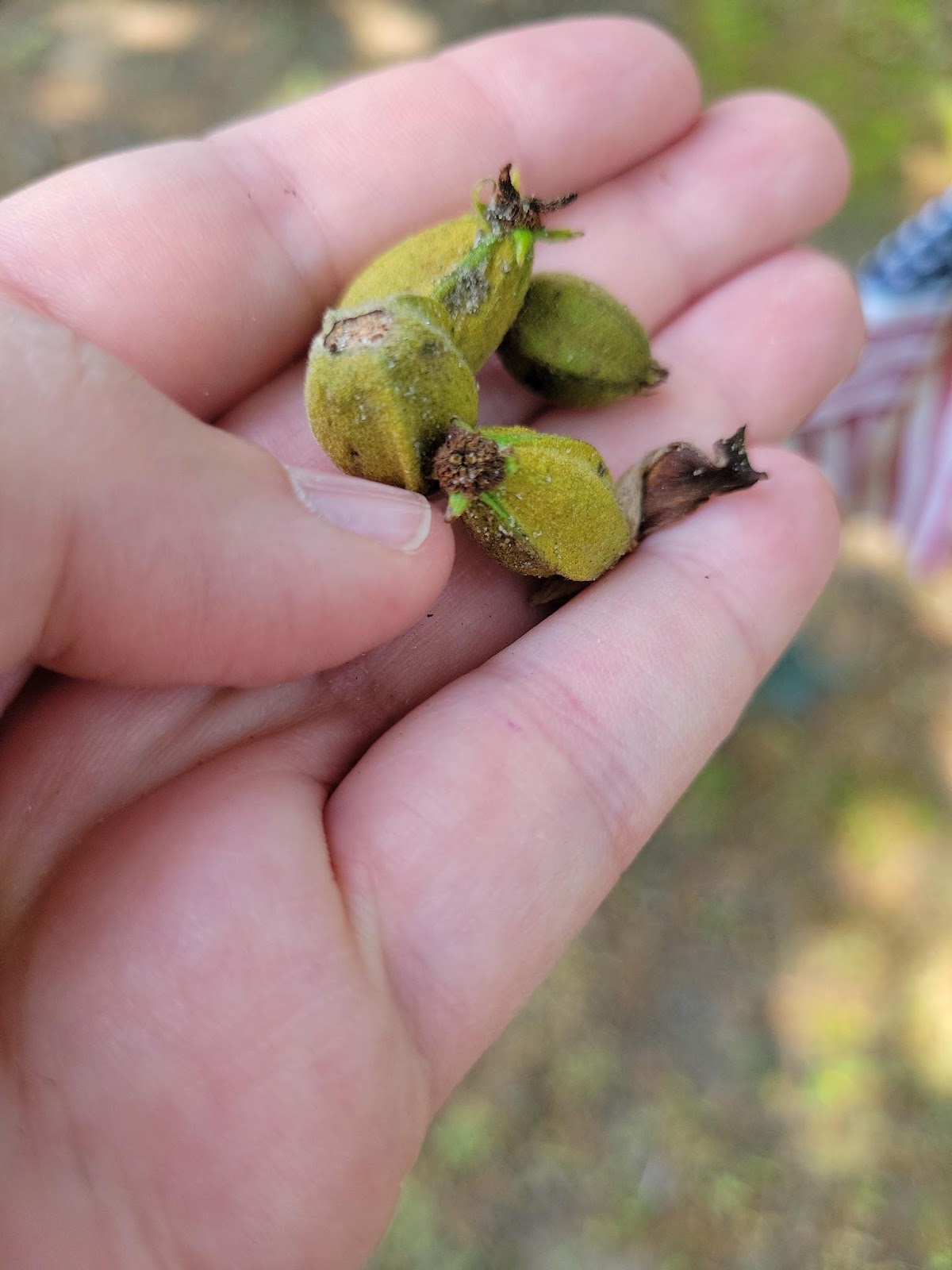
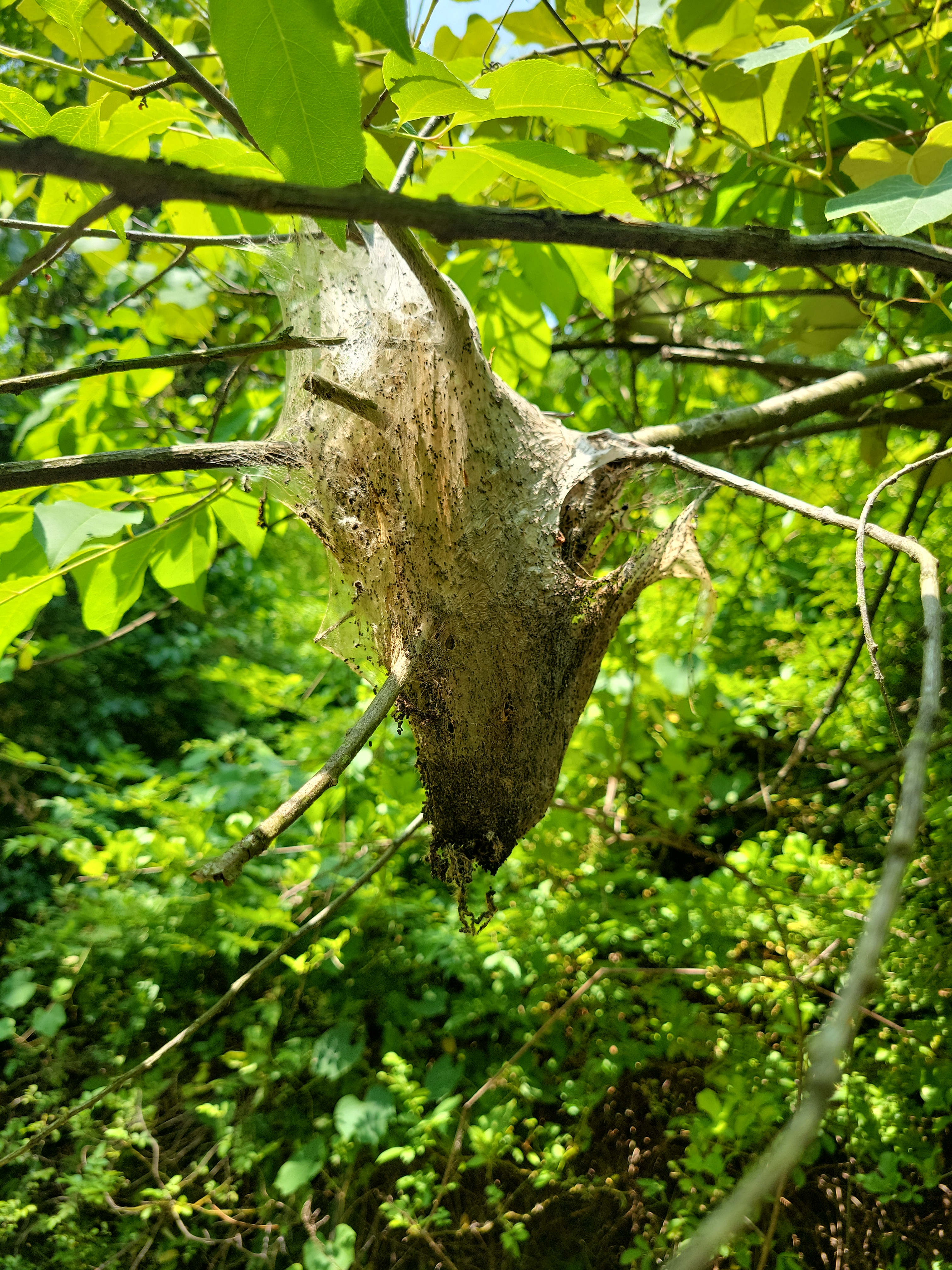
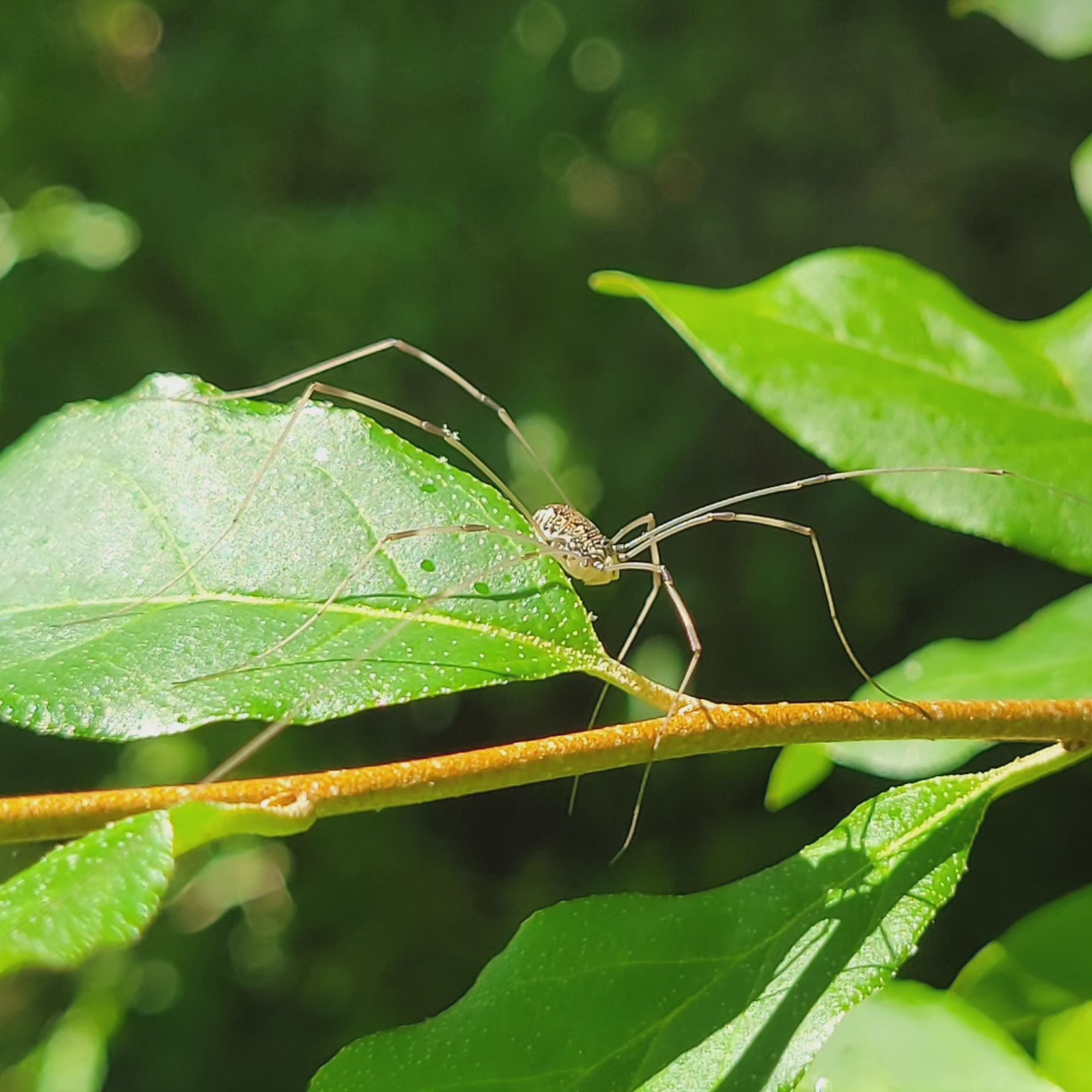
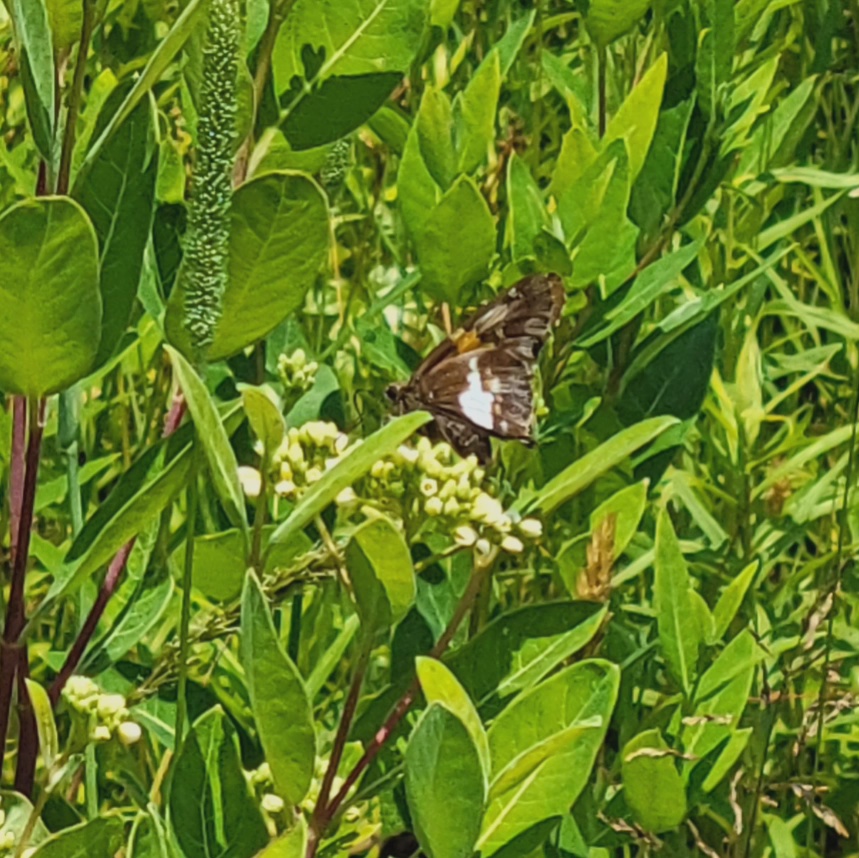
The Old Field featured a wide variety of grasses and forbs, as well as many macroinvertebrates actively pollinating the meadow. We identified yarrow (Achillea millefolium), common milkweed (Asclepias syriaca), Indian hemp or hemp dogbane (Apocynum cannabinum), red clover (Trifolium pratense), and ox-eye daisy (Chrysanthemum leucanthemum) were all in bloom. I was surprised to learn that many of the grasses were introduced species: timothy grass (Phleum pratense), orchard grass (Dactylis glomerata), and reed canary grass (Phalaris arundinacea) (Photo 9) were abundant, although a few native species including soft rush (Juncus effusus) were also visible. There were also scattered trees and shrubs, including sweetgum (Liquidambar styraciflua), the introduced species autumn olive (Elaeagnus umbellata), and a persimmon tree (Diospyros virginiana) with yellow buds just visible. We saw many butterflies and other winged insects, although they were difficult to photograph and identify; I also saw some kind of harvestman (Opiliones spp.) and many Eastern tent caterpillar moth webs (Malacosoma americana).


Our soil sample featured minimal organic matter, since grasses break down quickly. The Ap horizon (0-2.5″, p indicating that the land has been plowed) seemed to be fine sandy loam, brown in color. The B horizon was also fine sandy loam, with a slight green cast from the glauconite sand typical of the Marshalltown formation.
The sweetgum successional forest was dominated by slender sweetgum trees (Liquidambar styraciflua) and carpeted with the introduced species Japanese stiltgrass (Microstegium vimineum). Other species seemed to struggle to thrive in this plant community.

As we entered the mature sweetgum forest, where the sweetgum trees grew too tall for us to see their star-shaped leaves, we saw a few more shrubs, including American holly (Ilex opaca) and flowering dogwood (Cornus florida). The soil sample here (not pictured) featured sandy clay loam, slightly ribbony, with a slightly olive color.
The mature sweetgum forest abutted a conifer plantation–at one point you could see both plant communities on opposite sides of the trail. Established in 1957, the conifer plantation is dominated by Eastern white pine (Pinus strobus) with scattered introduced species including European larch (Larix decidua) and Norway spruce (Picea abies). We began to see fern species here, possibly marginal woodfern (Dryopteris marginalis), and striking red but closed buds of unripe wineberry fruits (Rubus phoenicolasius). We also identified Japanese barberry (Berberis thunbergii), an introduced species that often appears alongside Japanese stiltgrass.

As the trails wound toward the creek, we encountered some new-to-me species in the bluff forest, including the striking umbrella magnolia (Magnolia tripetala). Having grown up in the southeastern United States, I think of magnolias as small trees with hard, tough, shiny leaves and enormous, easily bruised white flowers; I am constantly surprised to encounter northeastern magnolias with soft, flexible leaves. (These magnolias were not in bloom.) We saw a variety of trees along these slopes–some quite large, such as an enormous chestnut oak (Quercus montana). A forest spring created the moist environment preferred by skunk cabbage (Symplocarpus foetidus).
In the low-elevation floodplain forest, we saw a blend of some species found throughout the park (sweetgum, red maple) and some of the species I recognized from the Outer Coastal Plain, particularly sweet pepperbush (Clethra alnifolia) and highbush blueberry (Vaccinium corymbosum)–and, once we reached the edge of the tidal freshwater marsh, spatterdock (Nuphar advena) and arrow arum (Peltandra virginica).
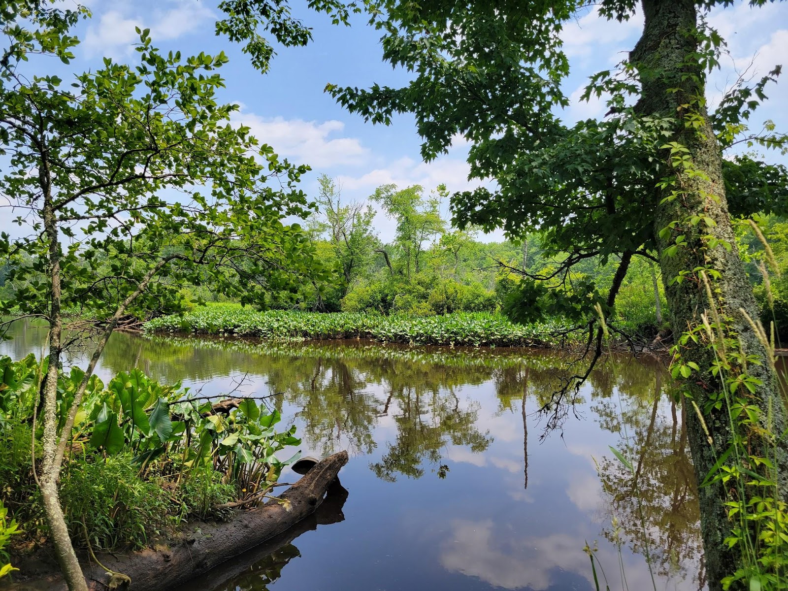
This freshwater marsh is tidal, but has less than .5 parts per thousand (ppt) annual average salinity. Wild rice (Zizania aquatica) thrives here, but I was surprised not to see the introduced species I am accustomed to finding in wetlands parks, such as common reed and purple loosestrife. We did see evidence of beavers (Castor canadensis) in this area. The soil sample (not pictured) was dark gray and mucky, without clear horizons; in other words, consistent with waterlogged soils with highly decomposed organic matter.
Conclusion
Those of us who walked ahead took a wrong turn heading back to the Nature Center–which is perhaps not surprising, considering how homogenous (although beautiful and verdant!) this sweetgum forest tended to be. However, we saw a pair of deer (possibly white-tailed, Odocoileus virginianus) as we found our way back, so it was worth the detour.
Walking through these three sites was an opportunity not only to reflect on how geological history impacts a region’s ecology, but how human history impacts it as well. Especially in Rancocas, where the impacts of 19th-century agriculture still shape the land, and literal remnants of 19th-century industry can dominate a plant community–by which I mean the Japanese stiltgrass, which is thought to have been introduced to North America as a packing material for porcelain. The influence of a human eye can be seen in the conifer plantation, where some of the white pines grow in an allee formation–which is not a pattern typically adopted by the pines, but it doesn’t seem to hurt them. And not only a human but a goat’s touch actively stewards Mount Holly, weeding out the English ivy. It may seem obvious to state, but human history is part of ecology; whether human impacts help or harm these environments depends on so many things, but intention is rarely one of them.

Hi Sara,
I enjoyed your detailed descriptions of all the different environments. Your ecology course sounds amazing. Also thanks for the tip about the Merlin bird call app – I’ll have to try it out and see how it works in Australia!
Thank you, Philip! I think Merlin does have the ability to recognize species in Australia–you may have to download a regional update for it, though. Enjoy! I struggle to visually ID birds so I love getting an idea of what’s hidden but audible around me.
[…] a field of grasses and flowers, both native and introduced. There were some I recognized from Rancocas State Park: orchard grass (Dactylis glomerata), timothy grass (Phleum pratense), hemp dogbane or Indian hemp […]
[…] Serpentine bedrock underlies the wooded trail off Sugartown Road and adjacent fields, but is deep enough below the surface that the soil supports mature trees. The trail is shaded by a canopy of various oak species, including white oak (Quercus alba) and pin oak (Quercus palustris), as well as Virginia pine (Pinus virginiana) and shagbark hickory (Carya ovata). The understory was nearly overrun by what appeared to be roundleaf greenbrier (Smilax rotundifolia), although when we turned over their leaves and saw that some of them had pale undersides, we knew that catbrier (Smilax glauca) was also present. Brambles (Rubus spp.) and scattered deerberry (Vaccinium stamineum) and lowbush blueberry (Vaccinium pallidum) shrubs were scattered throughout. We identified black cherry (Prunus serotina) in shrub form, some with black cherry finger gall mites (Eriophyes cerasicrumena) on the leaves; these were blackened, rather than the bright orange galls we observed last month in Mount Holly. […]
[…] got interested in galls during my ecology class field trip–for example!–so I loved reading this interview with the folks who created a website for identifying galls […]